Surveying Brisbane
Why You Need a Survey for Your Brisbane Project?
Surveying is a critical first step in any land or infrastructure project whether you’re working on a new building, roadway or utility installation. In Brisbane, local councils or certifiers often mandate certified survey plans for development approvals. Without this verification, you risk delays in approvals, costly rework or project shutdowns due to non-compliance.
At Lambert Locations, we deliver AS5488-compliant surveying services designed to meet councils’ standards and support the full project lifecycle from pre-design investigation to final asset handover.
Our Surveying Services in Brisbane
At Lambert Locations, we specialise in delivering certified, AS5488-compliant surveying solutions supporting both private and public sector projects in Brisbane.
Our licensed technicians use industry-grade electromagnetic and radio frequency tools to detect and map underground services, including power, water, gas and communications. These pre-design investigations help prevent accidental strikes and support safe excavation practices.
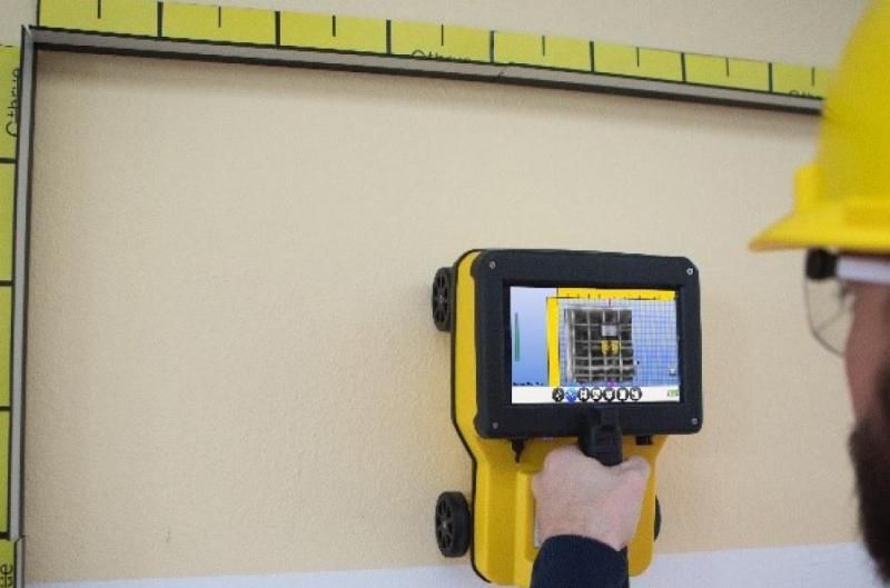
We use high-resolution GPR systems to scan beneath the surface and identify non-metallic utilities, voids, buried structures and subsurface anomalies. Our GPR surveys deliver accurate depth readings in real-time, suitable for both urban and remote environments.

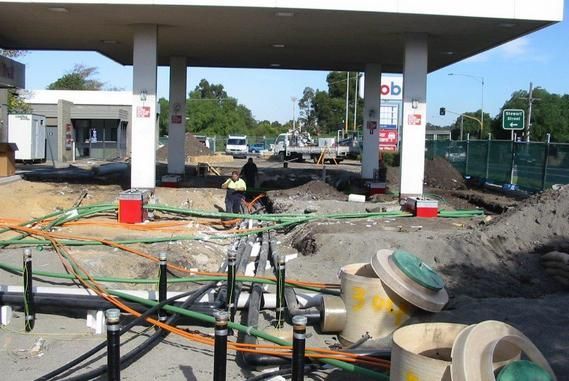
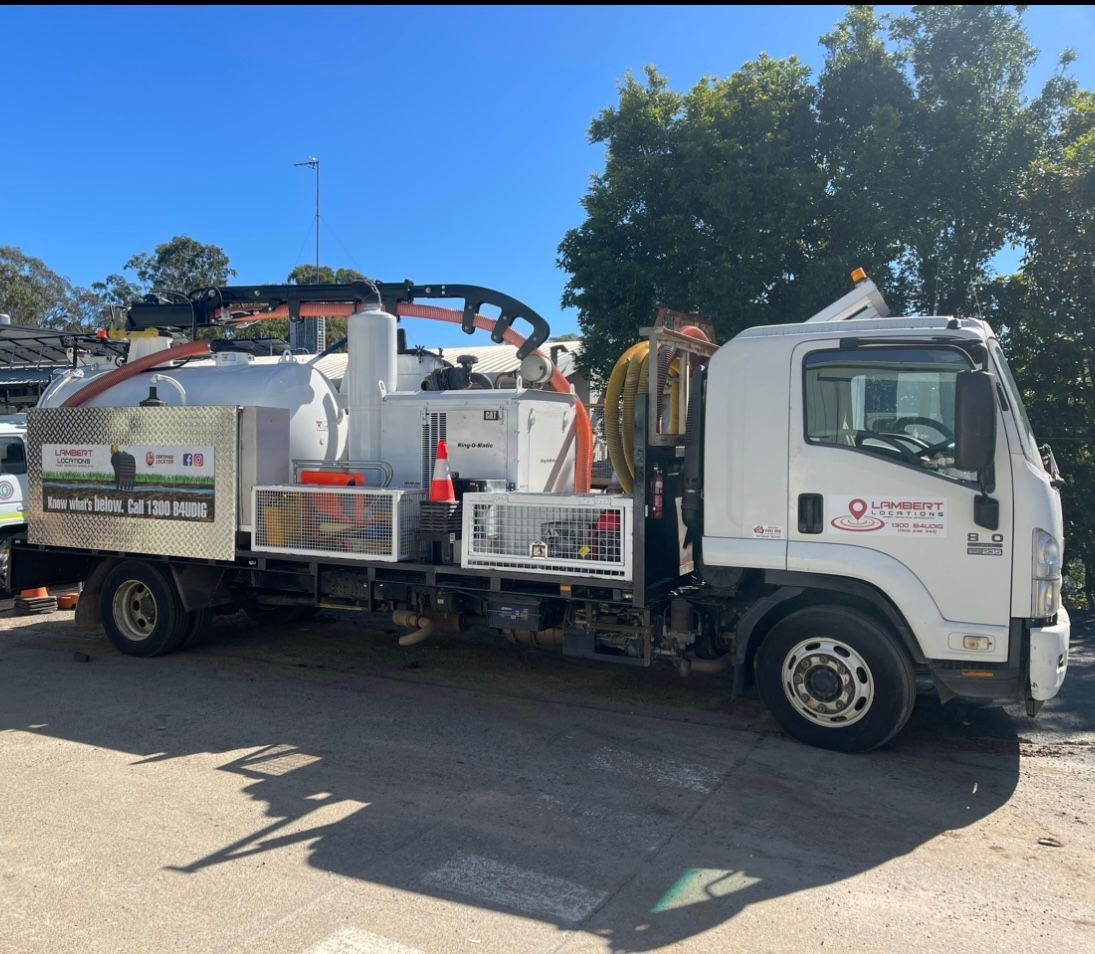
By physically exposing subsurface utilities using precise vacuum hydro excavation, our team provides designers and project managers with verified data on existing service alignments and configurations. This information is ideal for confirming service depths and avoiding damage to live utilities.
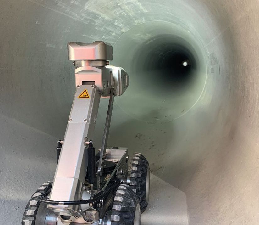
We inspect internal pipe conditions using remote-controlled CCTV crawlers to identify blockages, breaks or root intrusions, and capture high-definition footage. Used with GPS-tracked mapping, this service provides a complete picture of underground drainage systems.
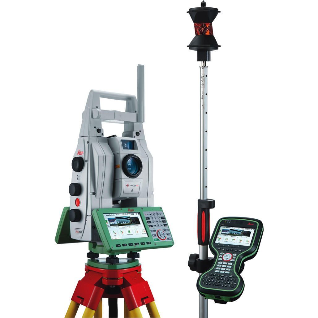
Our surveyors can do a complete location and pickup for existing services. Our surveyors create a visual image of underground and aboveground utilities as they appear on site. These data can be used to validate existing plan information, providing true service alignment locations with respect to roads, kerbs or property boundaries for new installations.
Our drone surveying service captures high-resolution aerial imagery and 3D terrain models. We use RTK GPS-enabled drones to deliver photogrammetric outputs for site monitoring, progress tracking and large-area coverage with minimal disruption.

Our non-invasive concrete scanning uses radar to identify rebar, post-tension cables, conduits and voids before coring or cutting. This ensures structural safety and prevents costly repairs during modification or demolition work.
As-Constructed Plans – Surveying Queensland
As-Constructed Surveys
As-constructed surveys are conducted during the construction phase to verify that the project, such as roads, drainage and utility installations, is being built according to approved design plans. These surveys capture the real-time position, elevation and dimensions of works in progress. Local councils often require these surveys for compliance and planning sealing processes before accepting infrastructure assets.
GPS/AutoCAD Drawing
As-Built surveys
Survey of the completed building or scope of works which are compared and submitted with the “issue for construction” set of plans.
Typical cases that would require these types of surveys are:
Newly Built Structures
New Roads (Kerbs, bitumen levels)
Sewer and Stormwater Drainage
Location of Services (Gas, Water and Power)
Asset Management
We provide complete surveying solutions throughout South East Queensland including the Gold Coast and Brisbane QLD. Our proven techniques are used extensively for civil construction, surveying and underground service location.


Frequently Asked Questions
Before I dig for a new fence, pool or any landscaping project in Brisbane, what survey do I need?
Before any Brisbane excavation, you need a professional underground service locating survey to accurately map utilities like pipes and cables, going beyond basic BYDA plans for safety. This often involves technologies like Electromagnetic Locating (EML) and Ground Penetrating Radar (GPR) meeting AS5488 standards to prevent costly damage and ensure safety.
What survey plans does Brisbane City Council require to approve my new house build?
Brisbane City Council typically requires a detailed site survey plan, often produced from an engineer survey, showing boundaries, topography and existing site features for most building project approvals. These certified plans are essential for your design process and demonstrate how your project complies with local planning schemes.
How can I clarify my Brisbane property boundary with a neighbour?
To find your exact Brisbane property boundaries, you'll need a boundary survey (or identification survey) conducted by a registered surveyor. This involves researching official records, detailed fieldwork to locate or re-establish boundary corners and the preparation of a certified plan.
What kind of survey or inspection do I need to do to locate pipe blockages or damage?
For Brisbane stormwater drainage issues, a CCTV Pipe Inspection survey uses remote-controlled cameras to visually examine the inside of your pipes. This inspection can effectively identify blockages, breaks, root intrusions, or other types of damage causing the problem.
If I'm cutting or drilling into concrete floors or walls, what survey do I need?
Before cutting or coring concrete in your Brisbane project, a concrete scanning survey uses radar technology to detect embedded items like rebar, post-tension cables, conduits or pipes.
What's the best way to locate existing underground utilities (power, water, gas, NBN, drainage)?
The most reliable way to map all underground utilities on a Brisbane development site pre-design is through a comprehensive Subsurface Utility Investigation (SUI). This uses multiple methods like electromagnetic locating (EML), Ground Penetrating Radar (GPR), and physical verification to AS5488 standards, providing a far more detailed picture than utility plans alone.
Trust Lambert Locations to detect, locate and map your underground assets with precision and technical analysis before you dig! Contact our team and tell us about your project today!